Take Action not to cut off of Loch Raven Trails

This is a forward from the International Mountain Bikers Association. Click the link to send an email to relevant city Councilors and Mayor Dixon.

I’m sending this to all the ATB riders I know in the area – I hope you will do the same

Take a few minutes and click this link https://secure2.convio.net/imba/site/Advocacy?cmd=display&page=UserAction&id=289

Fill out the form and let the leaders who want to shut off Loch Raven access that there are a lot of concerned MTB users.

They did this to us a decade or so ago and the tremendous response earned us the right to keep riding the singletrack there, let’s do it again.

You know it is serious when IMBA gets behind the effort, time to step up!

Jones Falls Trail Walk Through on a Snowy Morning

by Jonathan Cooper

The first real snow of the year did not deter about twenty Mt. Washington residents from participating in a walk through of a small piece of our section of the planned Jones Falls Trail, known as Phase V. Once completed, the Jones Falls Trail will be a walking/hiking/biking path, extending for ten miles through Baltimore City along the Jones Falls river valley, connecting twenty neighborhoods with the Inner Harbor, Mt. Vernon, and Lake Roland. In Mt. Washington, the trail will run from Cylburn to the Village, covering a distance of two miles.

Saturday’s walk through was led by Gennady Schwartz, Chief of Engineering Services for the Baltimore City Department of Recreation and Parks, hosted by the Mt. Washington Pediatric Hospital, and organized by David Conn, who chairs the Jones Falls Trail Committee of the Mt. Washington Improvement Association (MWIA).

After convening in the warmth of the Pediatric Hospital’s lobby, we headed out into the wet and heavy snowfall towards the woods. Mr. Schwartz led the group, which included MWIA board members and neighbors of all ages, including two children, to the corner of West Rogers Avenue and Wildwood Lane to start the walk. You can refer to the map below, which was generated by the GPS log from my iPhone, to see the path that we walked.
Continue reading “Jones Falls Trail Walk Through on a Snowy Morning”

Loch Raven mountain biking hearing

[From our mail bag:]

In your 12/1 Spokes about Loch raven mountain biking, you wrote (or transcribed):

There will be a hearing on Mon 12/14 with the DPW and Mary Pat Clark (Balto City Council). Open to the public. Location and time will follow as soon as I find out. Please prepare concerns, ideas / solutions.

Unfortunately, this is not true. The hearing will be scheduled probably in January, after two more readings of the resolution, and reports from DOT and DPW. Public comment and written testimony will be welcome then.

On December 14th, there is a small meeting with Ms Clarke and some of the stakeholders to establish goals and expectations for the hearing. This meeting is not the place for public comment, and is only open to the few people on the City hall access list which has been created for it.

Could you please issue a clarification?

Thanks,

Greg Hinchliffe

Issued a warning ticket for riding my bike at Ft. McHenry

[From our mail bag:]

All paths within FT. McHenry are closed to cyclist until the new construction is complete Oct 2010. The rangers/federal police officers, informed me there are signs posted. I did not see the sign when I entered the property. The only reason I was given a warning ticket instead of verbal warning is because the director wants to document all encounters with cyclist. Of course they did run my drivers license in their, I assume federal, computer system. Both officers were very polite and friendly, probably because I was open and honest answering their questions. They also liked the One Less Car sticker on my bike. If I would have been issued a ticket, instead of a warning, the fine is $150.

Loch Raven reservoir update

[From our mail box:]

The group ran into Dept of Public Works Natural Resource Div officer Simon Phillips on the fireroad. This was on the back side of the reservoir near the small dam. He was clearing the fireroad of debris when the group rode up on him. He informed us that we were riding on a fireroad that was not authorized for recreational use. He sympathized with our cause but was committed in doing his job by the book. The officers receive their direction from the Dept of Publc Works. It is in our best interest to be receptive and non confrontational until this is resolved.

The DPW is enforcing the laws that have been on the books since 1999 in regards to recreational use of the watershed. People will be given verbal warning with the second warning resulting in a possible $100.00 fine. Warnings and fines are discretionary. Blatant night riding well after dusk appears to be an automatic fine.

It is rumored that a MB singletrack user on the Seminary trail received a $100 hit Sat. This was overheard in Performance bike shop. Several riders on the Merrymans loop received warnings and or tkts also. If you have not heard, 8-10 riders on 11/18 were given $100 tkts on the singletrack climb out to Providence Rd from the fireroad off of the Seminary loop.

The fireroads that appear to be ok to use are- 1. Seminary fireroad. 2. Providence Rd and Loch Raven Drive fireroad near gate. 3.Jarretsvile Turnpike entrance across from white house to Merrymans fireroad. Parking back on Dulaney Valley Rd. 4. Loch Raven Drive across from small island. Fireroad sits back off of the road about 25 yards. Fireroad is on left before bridge with cement sides. Please check DPW website for verification and maps. https://www.ci.baltimore.md.us/government/dpw/water/rnrs/index.php
You can use this web site to view the MB plan for Loch Raven. Map at bottom of plan page.

We were told that singletrack use is off limits to everyone at ALL. times. This applies to fisherman, hikers, joggers, equestians (horses), and MB. Sounds crazy but it sounds like that are going to follow the book with a magnifying glass.

Trail markings will be forthcoming. This will help designate trails that can be used for recreational use.

There will be a hearing on Mon 12/14 with the DPW and Mary Pat Clark (Balto City Council). Open to the public. Location and time will follow as soon as I find out. Please prepare concerns, ideas / solutions.

Finally, you are encourages to join MORE. They appear to be our best advocates locally. www.more-mtb.org/

Report on Roland Park’s Sunday Streets pilot: 25 October 2009

26
November 2009

Report
on the 25 October 2009 Roland Avenue
Sunday
Streets
pilot

Prepared
by

Mike McQuestion, co-Chair, Sustainability Initiative
(mike.mcquestion@gmail.com)

Phil Spevak, President (pjspevak@gmail.com)

Roland Park Civic League

Background

Through its Sunday
Streets Program
, the City of Baltimore proposes to close off
selected streets to motorized traffic during Sunday mornings, making
them available for recreational use. Sunday Streets is modeled
on Bogota, Colombia’s ciclovia.
Every Sunday, from 8AM until 1PM, a network of normally busy Bogota
streets is closed to motorists, allowing up to 1.7m residents to
traverse the city on bicycles, rollerblades, skateboards or on foot.
Bogota’s ciclovia has operated weekly since the early
1980s, providing residents in 70% of the city’s neighborhoods
with easily accessible recreational opportunities. The idea is
catching on. European examples include Copenhagen and Paris. In
Switzerland’s
Slow Up
Program, 35-50km segments of particularly
scenic roads are closed on consecutive Sundays during the summer
months for pedestrians, skaters and cyclists to use. At this
writing, 38 cities in eleven countries have organized ciclovias.
Routes range from 1 to 121 km in length. Duration of ciclovia
events ranges from 2 to 12 hours. The number of events ranges from 18
to 64 per year. Annual budgets range from US$45k to US$2.08m. In
Seattle WA, Cambridge MA, San Francisco CA and El Paso TX, ciclovias
happen at least every month during the cycling season. Ciclovia
programs are credited with improving physical fitness, engaging young
people in constructive social activities and increasing neighborhood
cohesiveness (Sarmiento
et al 2008
).

Sunday Streets
is an integral part of Baltimore’s
2009 Sustainability Plan
.

The City’s
street network is particularly conducive to Sunday Streets.
(For more on this, see Baltimore’s 2006
Master Bicycle Plan
.

City planners
prepared a detailed Sunday Streets implementation plan nearly
three years ago. The plan identifies specific streets and outlines
logistic and security procedures for the Police and Transportation
Department to follow. However, it has never been implemented,
ostensibly for budgetary reasons.

Supporters of
Baltimore’s Sunday Streets Program include the local
bicycling advocacy group One
Less Car
. In 2008, One Less Car developed a 5-mile
Sunday Streets pilot route which runs from Lake Montebello to
Druid Hill Park along 33rd Street. This “lake-to-lake
pilot, proposed for August 2008, was not implemented, again for
budgetary reasons (see below).

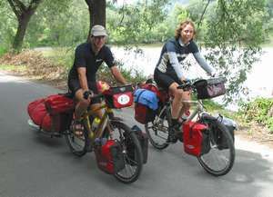
On October 25, 2009,
a modest, one-mile long Sunday Streets pilot was carried out
successfully on Roland Avenue, sponsored by the Roland
Park Civic League
. Details of that experience are
described below. Most notably, the activity was successfully executed
from plan to completion in 8 weeks.

Continue reading “Report on Roland Park’s Sunday Streets pilot: 25 October 2009”

Submit your bike data to Google

Google told us last month that they were working on bike directions, but they didn’t make a big deal out of telling us how to help. Well, I could be mistaken, but it looks like the offer to ‘partner’ on bike directions (and all sorts of ‘mappy’ features) is just sitting there, waiting for folks to get to it.

If you speak ‘nerd’, or know someone who does, then the rest of this could apply to you. There are some high-level FAQs about data formats, and a link to a form to fill-out if you have some data and you want to partner with Google to get your data integrated into Google Maps. The data we most care about here, of course, is bike-related data — bike lanes, routes, paths, etc.

Who has bike data? Well, cities and bicycle coalitions, probably — and/or the folks who hold the copyrights on maps/data, if they are copyrighted. [Of course you know how we feel about this type of data — it should be free free free.]

If you are a planner/GIS-type person in the Bicycle division of the San Francisco Municipal Transportation Agency, then maybe you can help Google get us some bike directions — just fill out the form and see what happens. Could the good folks of our local bike coalition (the folks who put out the bike map) possibly work with Google to get this done? Got me — there’s one way to find out. [SFBC is up to 11,000+ members, now.]

Whatever city or town you live in, do your best to convince someone — I’d start with your local walk/bike/transit advocacy organization, if you have one — to contact the city/town/municipal government and ask them to follow up on this.

What does bike data look like? A lot of it is over my head, but we can look at Google’s “Complete Map Content Specifications“. There are lots of details, of course, but the human-understandable parts are very cool. If you’ve wondered what the GTFS format for bikes was going to be, we may have our first draft.

Can the data format handle wide curbs vs. bike lanes vs. one-ways vs. two-ways vs. high-speed arterials vs. bike boulevards vs. contraflow lanes vs. buffered bike lanes? I’m not sure, but it looks like it’s pretty flexible and can handle most if not all of the crazy configurations and complexities that occur in road networks.

Continue reading “Submit your bike data to Google”

Aggressive drivers alert

Please note that aggressive driving is generally more pronounced before Thanksgiving. I recommend trying to take less traveled roads and/or going out of your way to be courteous to drivers (like pulling off to the side from time to time.) Or at the very least just try and stay cool and don’t let them get to you. After thanksgiving things tend to go back to they way they were (just so you know its not a sign of things getting worse.)

You never know who you’ll meet while cycling.

One thing I love about cycling, its a social activity. You are not separated from your fellow human beings by walls or metal cages and you can met some very interesting folks like this couple I ran into on Sunday:
image
On 01.06.2003 we started our tour around the world in Limburg, a small city about 80 Km north of Frankfurt in Germany. Our plans were to travel around the world with our bicycles (and somertimes with a folding canoe or our packrafts) within 3 or 4 years. The reason for this tour is to see the world with our own eyes, instead of believing the bad news on TV. We are going to to meet the people in every country, to built up our own opinion, and so far we have only very good experiences.
Continue reading “You never know who you’ll meet while cycling.”